See how many people drive the same roads as you in the Charlotte/Rock Hill commute
Many Charlotte workers live in York, Lancaster and Chester counties. And many workers in those counties travel to work in Charlotte each day. That means plenty of commute time on area roads.
But precisely how many drivers are we talking about?
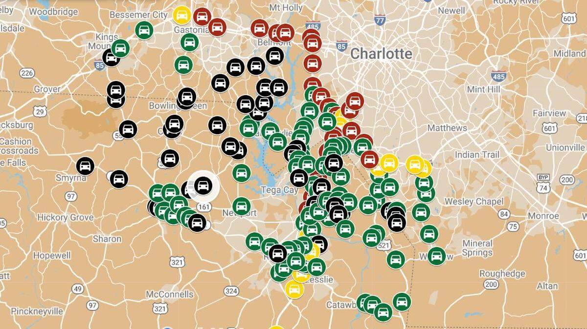
The Herald used most recent traffic count data from transportation departments in both states to create a Google map that focuses on the Rock Hill region and parts of south Charlotte. The map shows how many vehicles on average use a given stretch of road in a day.
The heaviest traffic predictably follows I-77, I-85 and I-485. Some spots see about twice as many vehicles per day as there are seats in Bank of America Stadium. Other roads carry far fewer vehicles but are key commuter routes.
Use the map below to find traffic counts for some of the most popular commuting routes in the Rock Hill, Fort Mill, Tega Cay, Indian Land areas, plus south Charlotte communities on the North Carolina side. Just zoom in to find roads of interest for your drive. Then click on the car icons. Red icons are highest traffic areas, followed by yellow, green and black.
If you like, click the icon at the top left and then the map image that comes with the information box to view in a Google Earth style.
This story was originally published January 9, 2023 at 12:00 AM.