Snow for Rock Hill? As usual, it’s a close call
It wouldn’t be a potential snowfall in the Carolinas without “close call” written all over it.
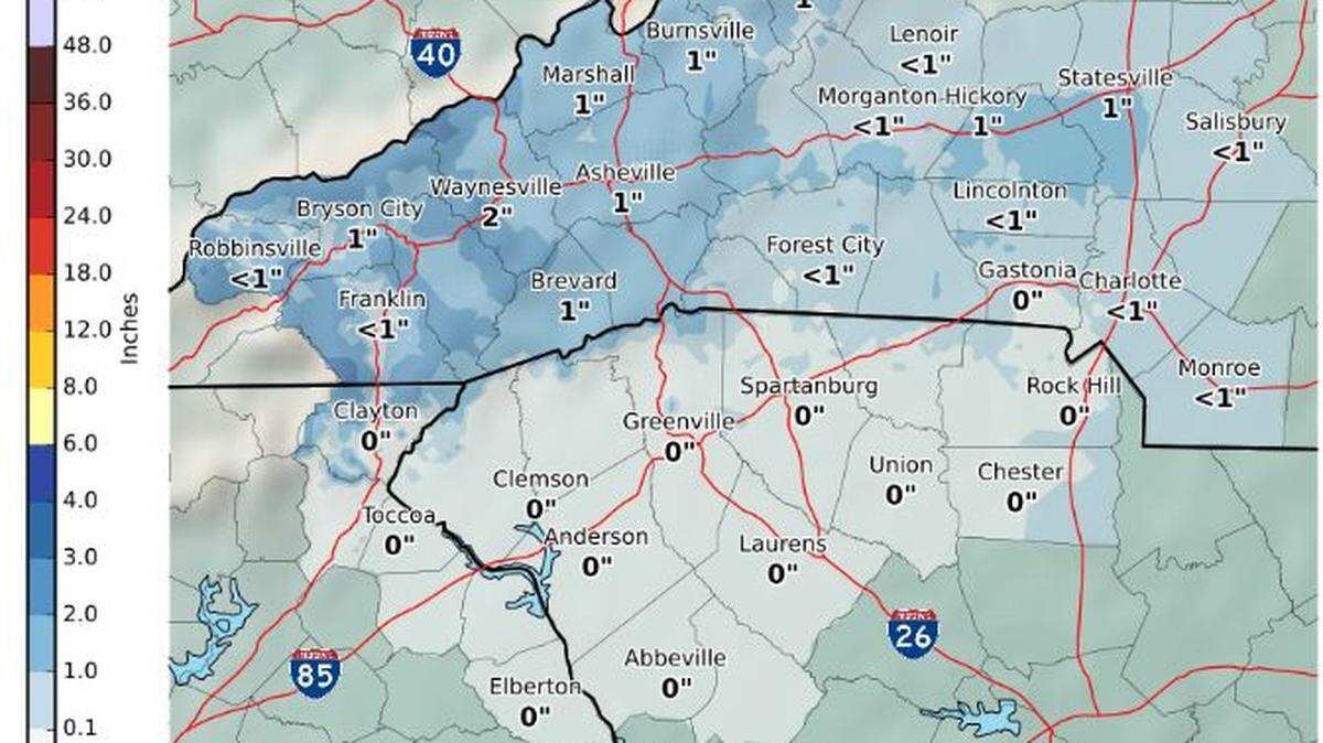
And that’s how forecasters are describing Rock Hill-area snow chances from a fast-moving storm system predicted to cross the region Thursday.
Meteorologists say they are fairly certain snowflakes will fall during the event, expected to last from around noon until late Thursday night. They are far less confident the snow will accumulate.
In fact, they might be more concerned about possible icing issues Friday morning.
The official forecast is for around a half-inch of snow to accumulate in the Rock Hill area, mainly on grassy surfaces. But a lot of uncertainty remains.
As is often the case in the Carolinas, temperatures will be the key factor, forecasters say.
Computer guidance has wavered over the past few days, but National Weather Service meteorologists say the current thinking is that precipitation will begin as rain in the Rock Hill area late Thursday morning, then change to snow at some point in the afternoon.
“Throughout the afternoon hours, the rain/snow line will shift southward into the Upstate as temperatures continue to fall,” says Justin Lane, of the National Weather Service office in Greer.
It all points to an event in which much of the snow that falls melts as it hits the ground, and roads remain mostly wet.
However, Lane said some computer guidance predicts temperatures will fall quickly enough for the rain to change to snow around noon in the Charlotte-Rock Hill corridor.
Lane says that’s “something to keep a close eye on.”
And, Lane notes, meteorologists will be watching closely for signs that temperatures might fall early enough for more snow to accumulate.
As the low pressure system reaches the Carolinas coast, it is predicted to strengthen. That means eastern parts of the Carolinas are expected to get more snow than the west.
Clearing is expected in the early-morning hours Friday, allowing temperatures to tumble into the 20s. And that could spell trouble for the Friday morning commute.
“Black ice issues will become a concern, especially given any residual water or snow on roadways and elevated surfaces,” Lane says.
While Friday brings cold temperatures, with highs not expected to climb much above 40, it also will be a sunny day. That should dry the roads and prevent another black-ice issue Saturday morning.
Temperatures are expected to moderate, with highs in the mid 50s Saturday and Sunday under skies that are at least partly sunny. Then comes the return of something that has been much more common than snow and ice this winter -- rain. Showers are forecast to return for Monday and possibly Tuesday.