Tornado threat expands, warnings issued in Columbia area as Hurricane Helene gets stronger
READ MORE
Hurricane Helene
Hurricane Helene is gaining strength and is forecast to track north toward SC where it will bring heavy rain & strong winds to the Midlands.
Expand All
Hurricane Helene is getting stronger as it churns toward the U.S., and is expected to bring severe weather to the Columbia area of South Carolina beginning Thursday.
Heavy rain and strong winds, along with possible tornadoes and flooding are threats Helene poses to the Midlands, according the National Weather Service.
A Tropical Storm Warning has been issued for Richland and Lexington counties, as well as all of the Midlands, National Weather Service meteorologists said in a Thursday morning briefing.

While the center of Hurricane Helene is not tracking over the Columbia area, that does not mean the Midlands won’t be affected. The storm’s impacts are expected to extend well beyond and to the east of the forecast track, bringing potentially severe weather to the Midlands, beginning Thursday afternoon and continuing through Friday morning, according to the briefing.
As Helene moves closer, the dangers of its winds grow more significant in the Columbia area. The tornado threat has expanded for all of the Midlands, while broader wind fields and increased gust potential are expected, the National Weather Service said.
At 8:30 a.m., a Tornado Watch was issued for all of the counties in the Midlands, according to the National Weather Service. The watch will run through 9 p.m.
The increased potential for tornadoes overnight pose a greater danger because of limited visibility and difficulty receiving warnings, meteorologists said.

A large wind field is expected east of Helene, bringing frequent tropical storm force gusts to most of the Columbia area late Thursday night into early Friday, according to the briefing.
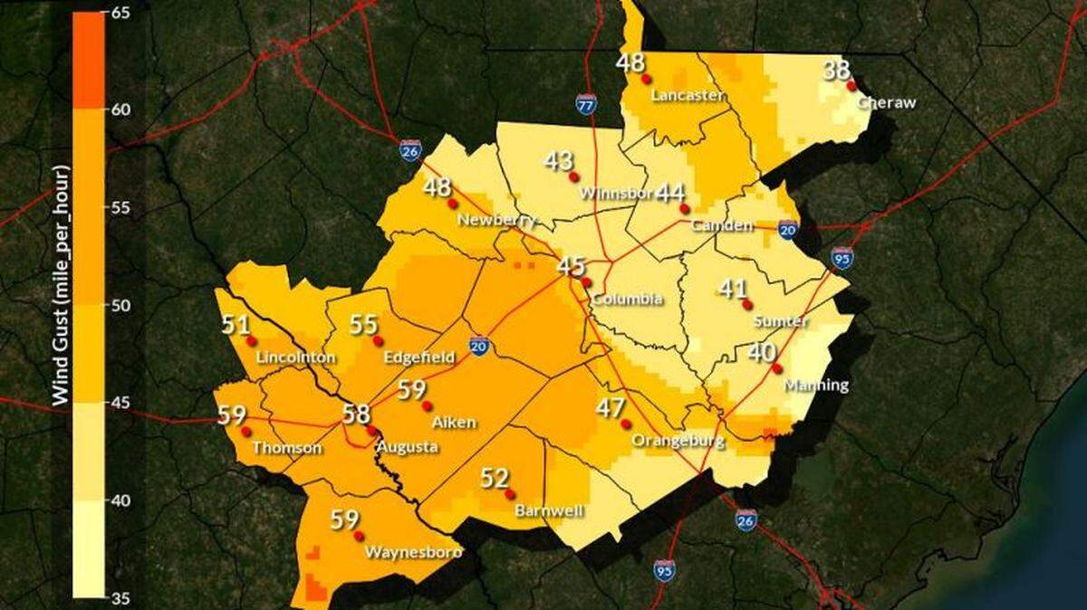
Gusts up to 40-55 mph are expected across the Midlands, with local higher gusts that exceed 60 mph possible, the National Weather Service said. Tropical storm-force wind gusts likely across the Midlands.
There’s a 93% chance of winds that exceed 40 mph being recorded in Columbia, according to the briefing.
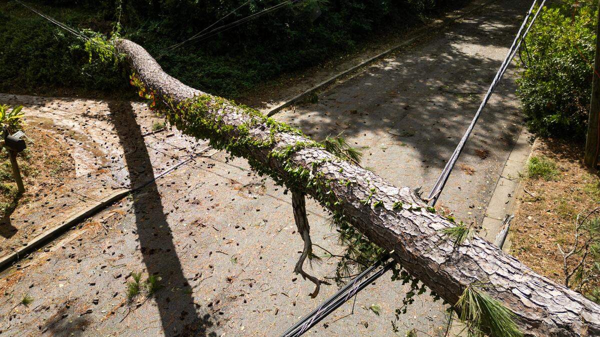
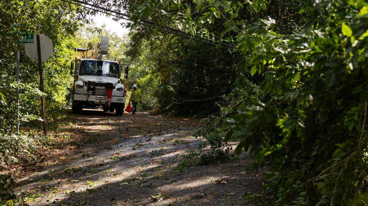
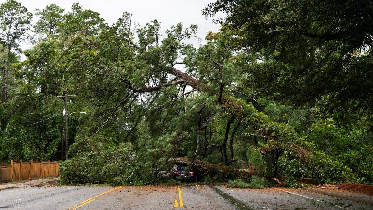
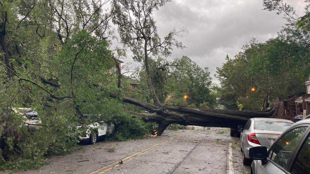
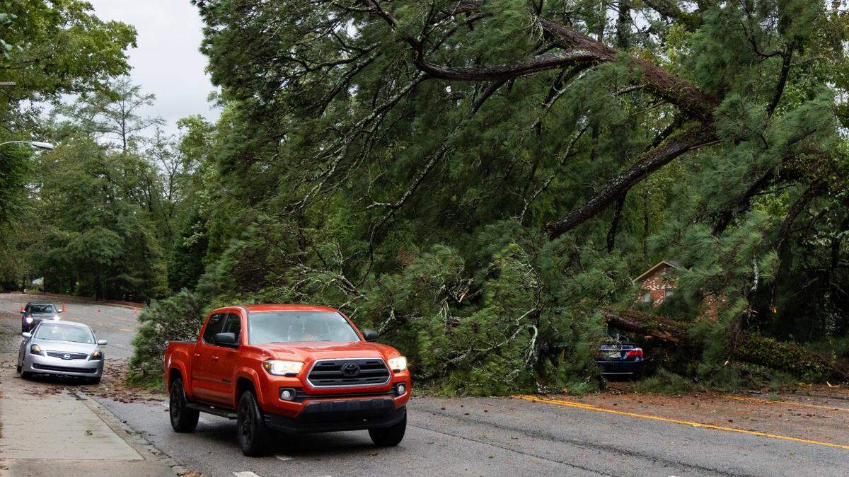
Powerful winds and tornadoes could cause considerable damage to trees and branches, in addition to mobile homes, roofs and outbuildings. Vehicles would also be under siege in the case of a tornado.
Damage to trees and branches creates the possibility of downed power lines and outages.

Rain already started falling the Midlands Thursday morning and was expected to intensify throughout the day while continuing to last through Friday morning, the National Weather Service said. Peak hours for heavy rain is forecast in the evening and overnight, according to the briefing.
The storm could cause between 2-4 inches of rain to fall in Columbia, the National Weather Service said. Localized amounts in other areas could be higher, especially in the western portion of the Midlands where there’s the potential for excessive rainfall.

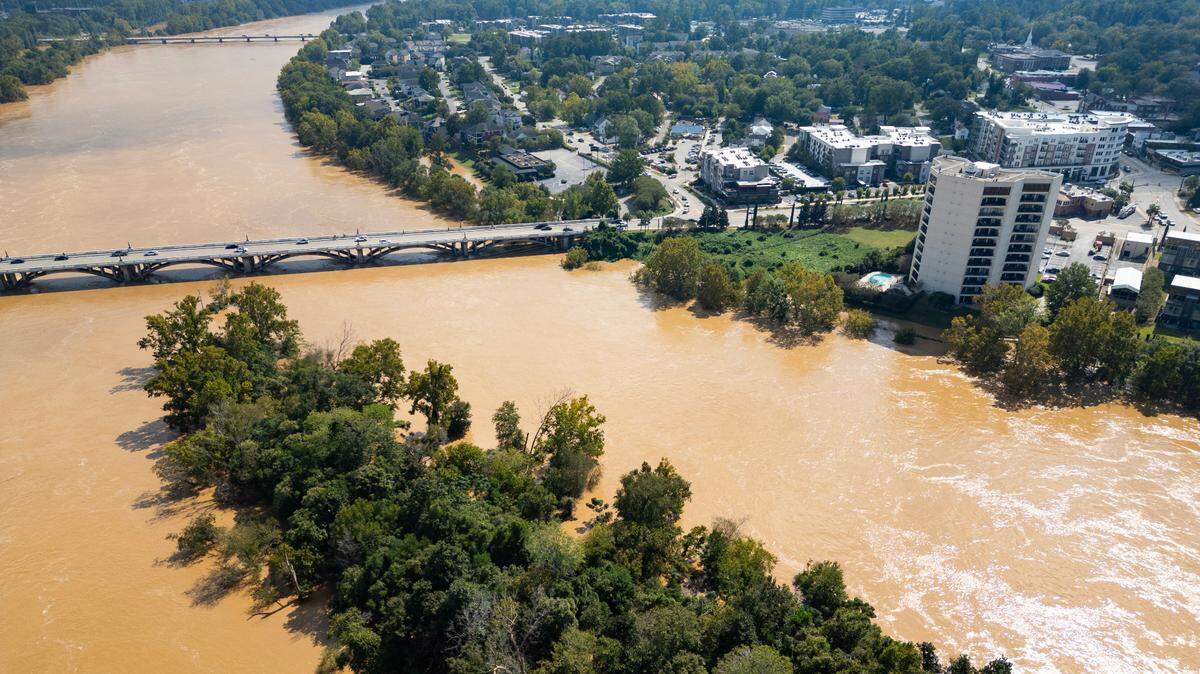
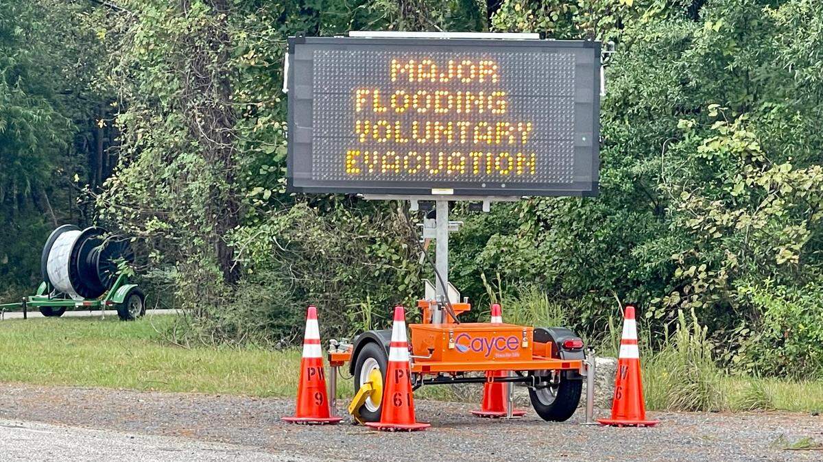
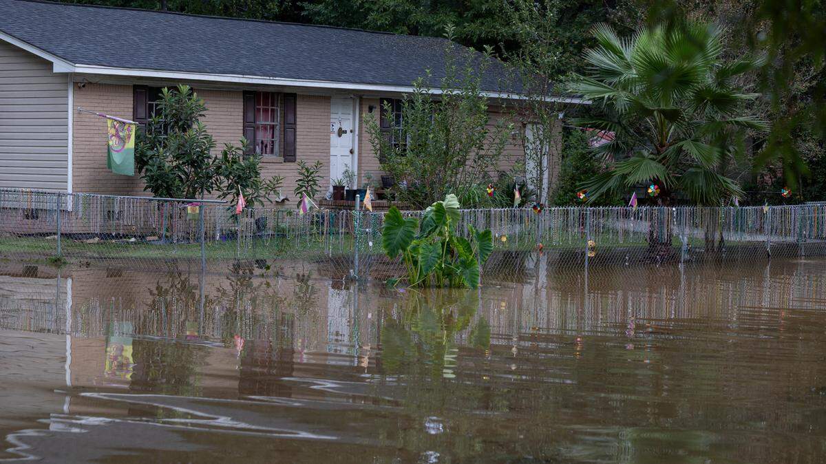
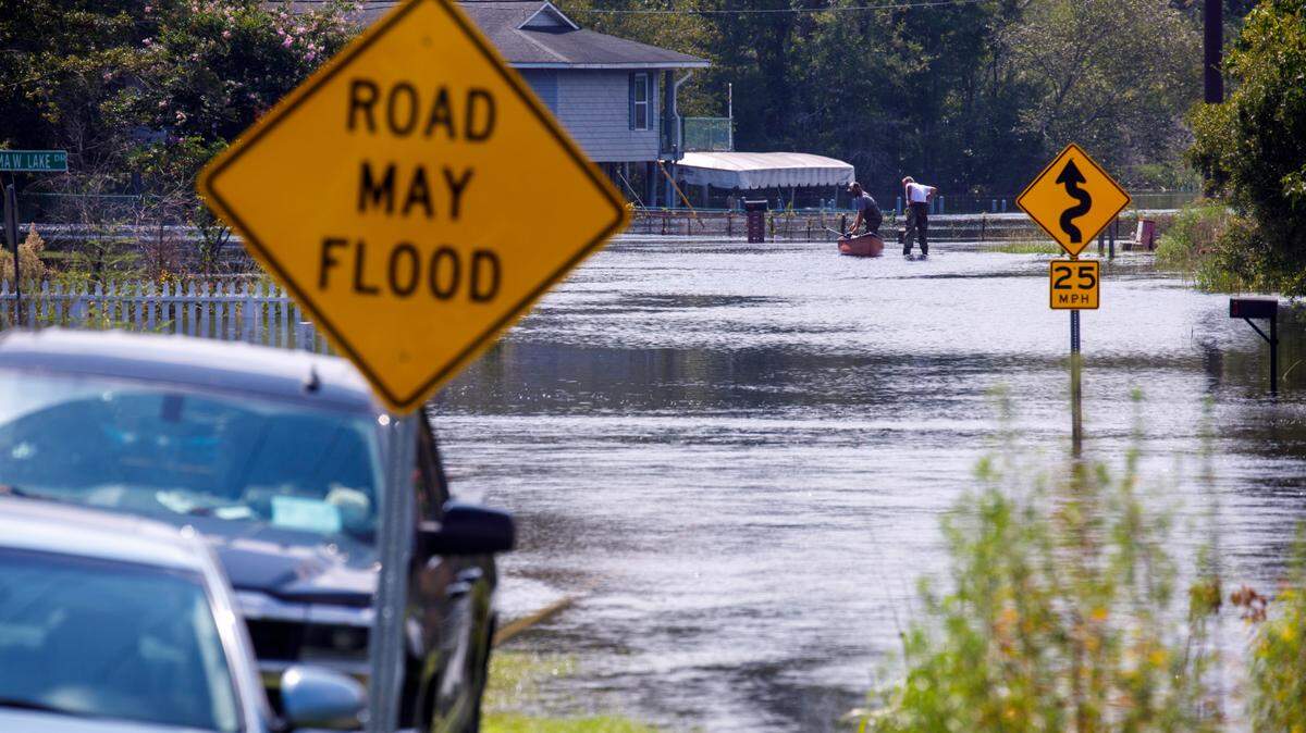
All of that rain could cause flash flooding, and eventually river flooding through the weekend and into next week, the National Weather Service said.
A Flood Watch is in effect for the southern portion of the Midlands, and flooding possible along the Saluda and Broad rivers, according to the briefing. The Flash Flood Watch is in effect through Friday afternoon.

As of 5 a.m. Thursday, Helene was a category 2 hurricane moving north at about 12 mph and had maximum sustained winds of 100 mph, with hurricane-force winds that extend out 60 miles from the center, as well as tropical-storm-force winds that extend out up to 345 miles, according to the National Hurricane Center.
Hurricane Helene is expected to continue growing stronger into a major hurricane before making landfall in Florida along the panhandle, the National Hurricane Center said. Helene is then forecast to track northward inland through Georgia.
Helene will weaken through Thursday night, the National Weather Service said.
Conditions in Columbia are expected to clear by Friday night, and the forecast for Saturday calls for sunny weather with a possible high temperature in the mid 80s.
The sunny conditions are expected to continue through the weekend and into the early part of next week, with high temperatures in the 80s, the forecast shows.
BEHIND THE STORY
MOREThis is a breaking news story
In a breaking news situation, facts can be unclear and the situation may still be developing. The State is trying to get important information to the public as quickly and accurately as possible. This story will be updated as more information becomes available, and some information in this story may change as the facts become clearer. Refresh this page later for more updated information.
This story was originally published September 26, 2024 at 8:45 AM with the headline "Tornado threat expands, warnings issued in Columbia area as Hurricane Helene gets stronger."